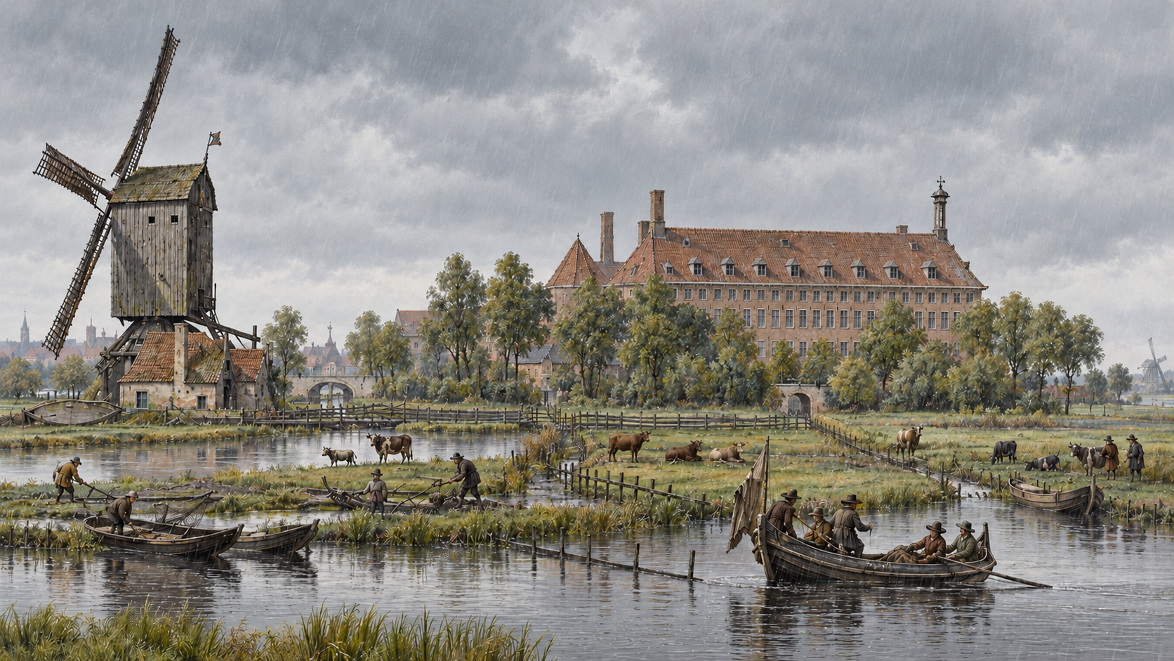
Amsterdam in the Seventeenth Century
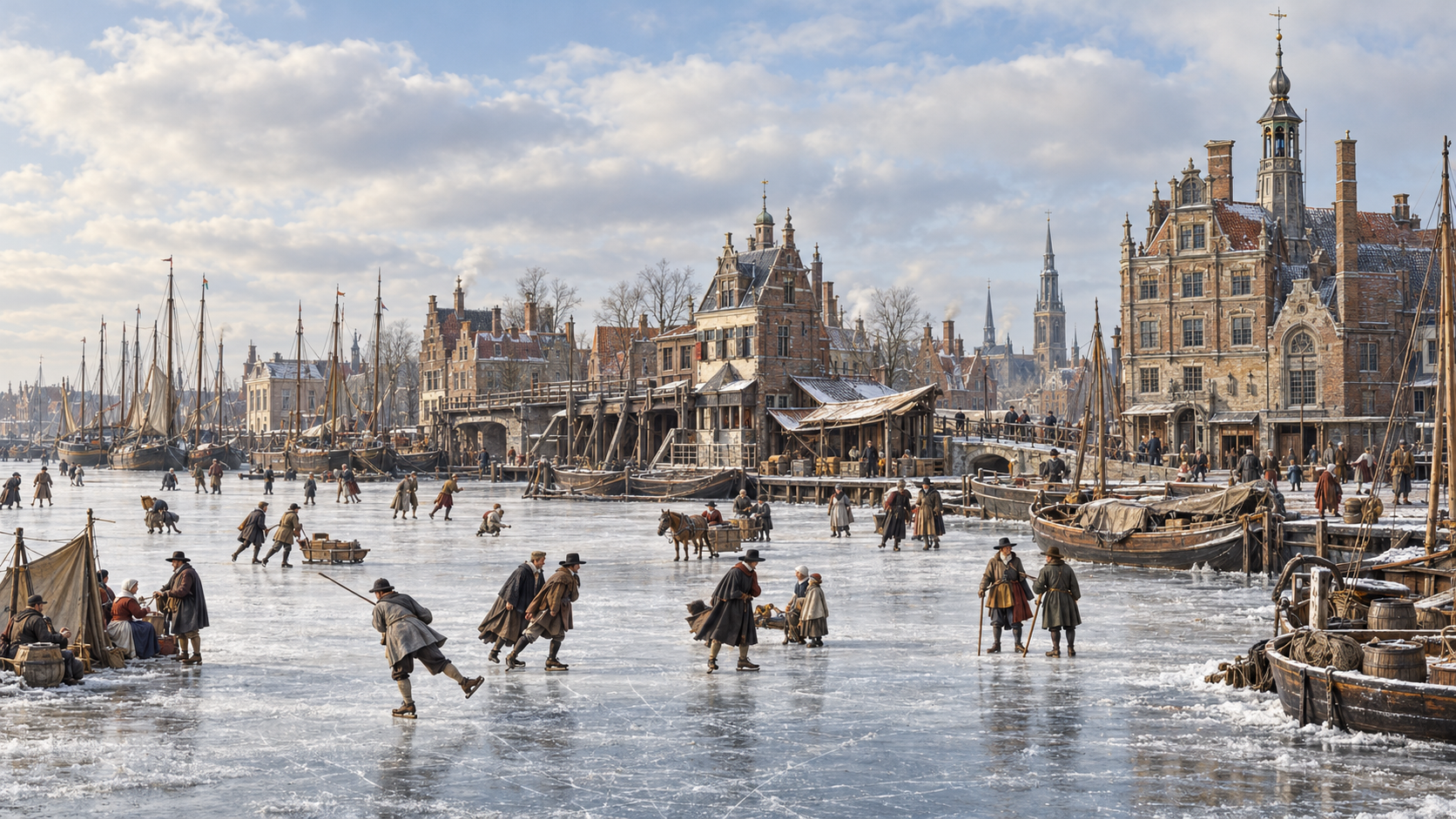
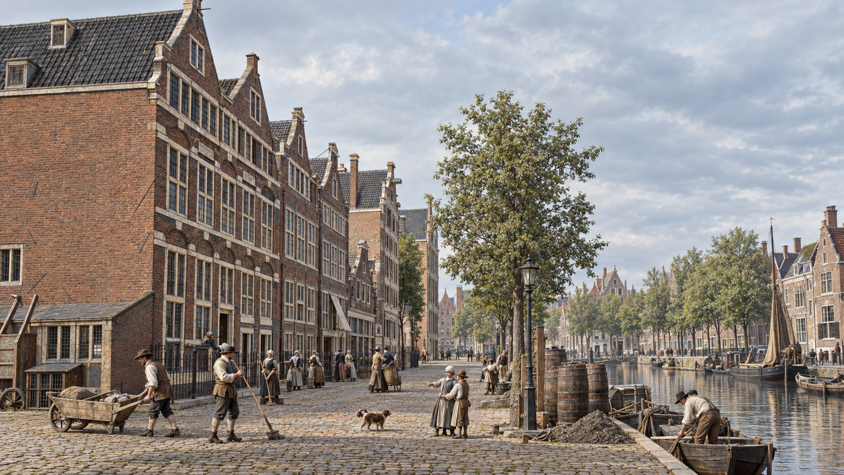
Een van de mooiste boeken van oud Amsterdam is Amsterdam in de zeventiende eeuw (1897). Op deze pagina worden de prenten daarin in kleur tot leven gewekt met behoud van hun compositie en de authenticiteit van de omgeving.
One of the most beautiful books about old Amsterdam is Amsterdam in the Seventeenth Century (1897). On this page, the prints within it are brought to life, while preserving their composition and the authenticity of the surroundings.
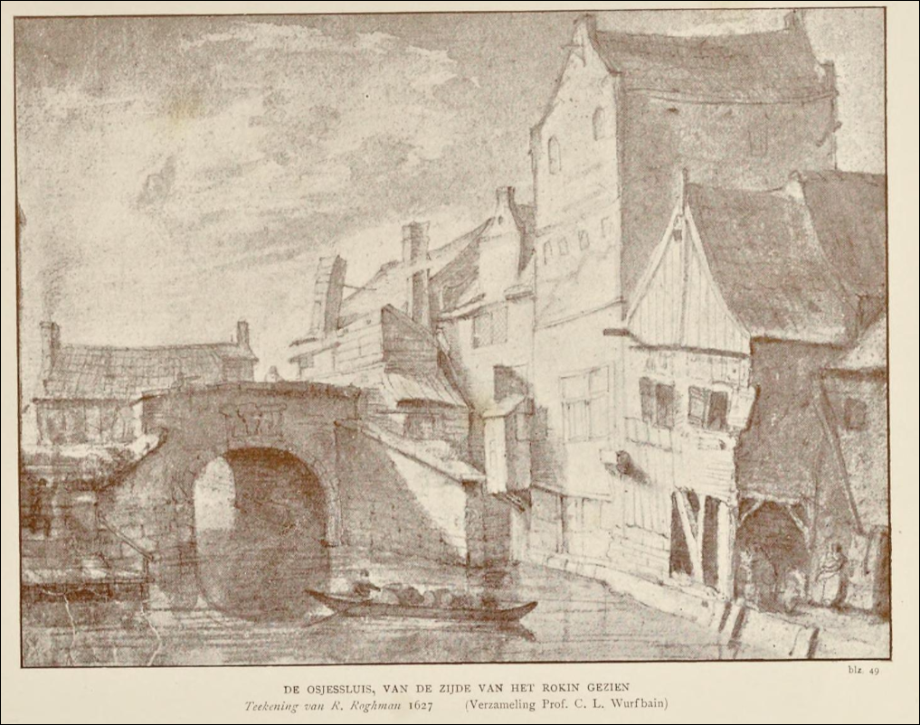
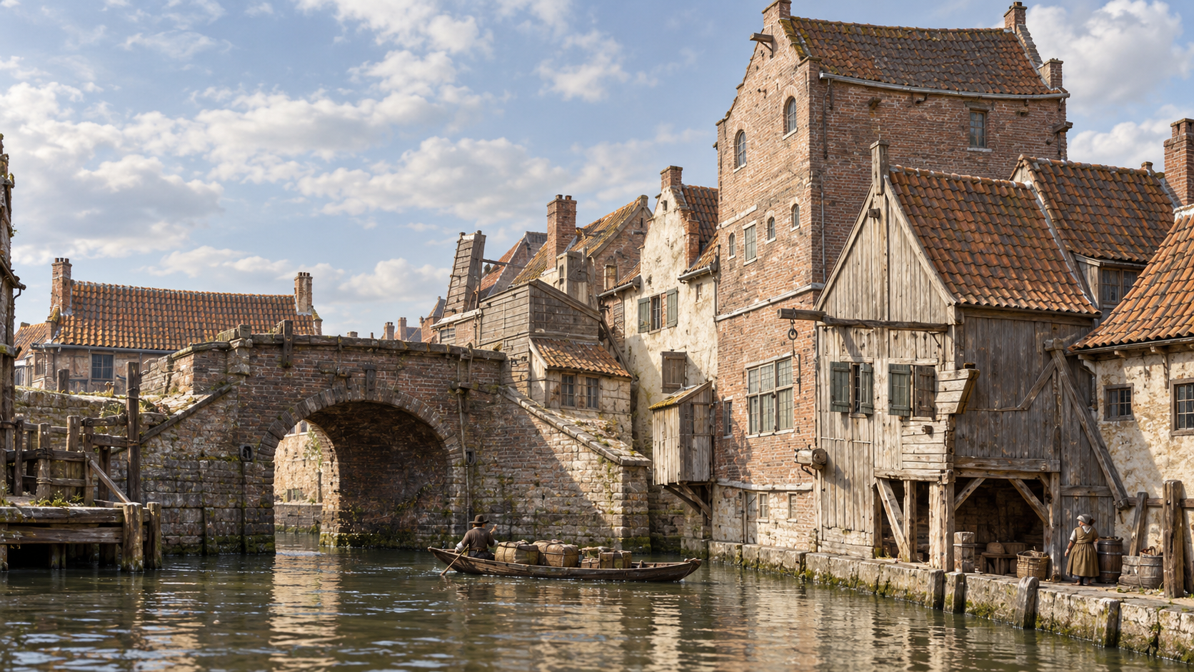
De veemarkt bestond vroeger uit twee delen: de Kalverstraat en de Osjessluis. Vanaf het Rokin keek je op de Osjessluis. De tekening dateert uit 1627.
In the past, the cattle market consisted of two parts: the Kalverstraat (named after the calf market) and the Osjessluis (named after the oxen market lock). From the Rokin, you looked out over the Osjessluis. The drawing dates back to 1627.
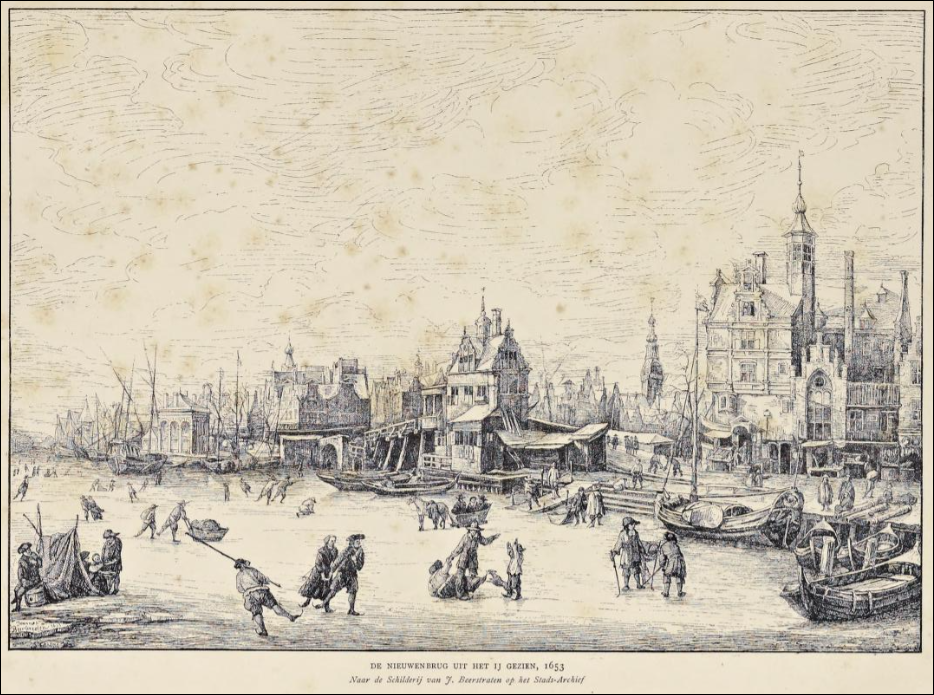
De Nieuwe Brug gezien vanaf het IJ, 1653, naar een schilderij van J. Beerstraten.
The Nieuwe Brug (New Bridge) seen from the IJ, 1653, after a painting by J. Beerstraten.
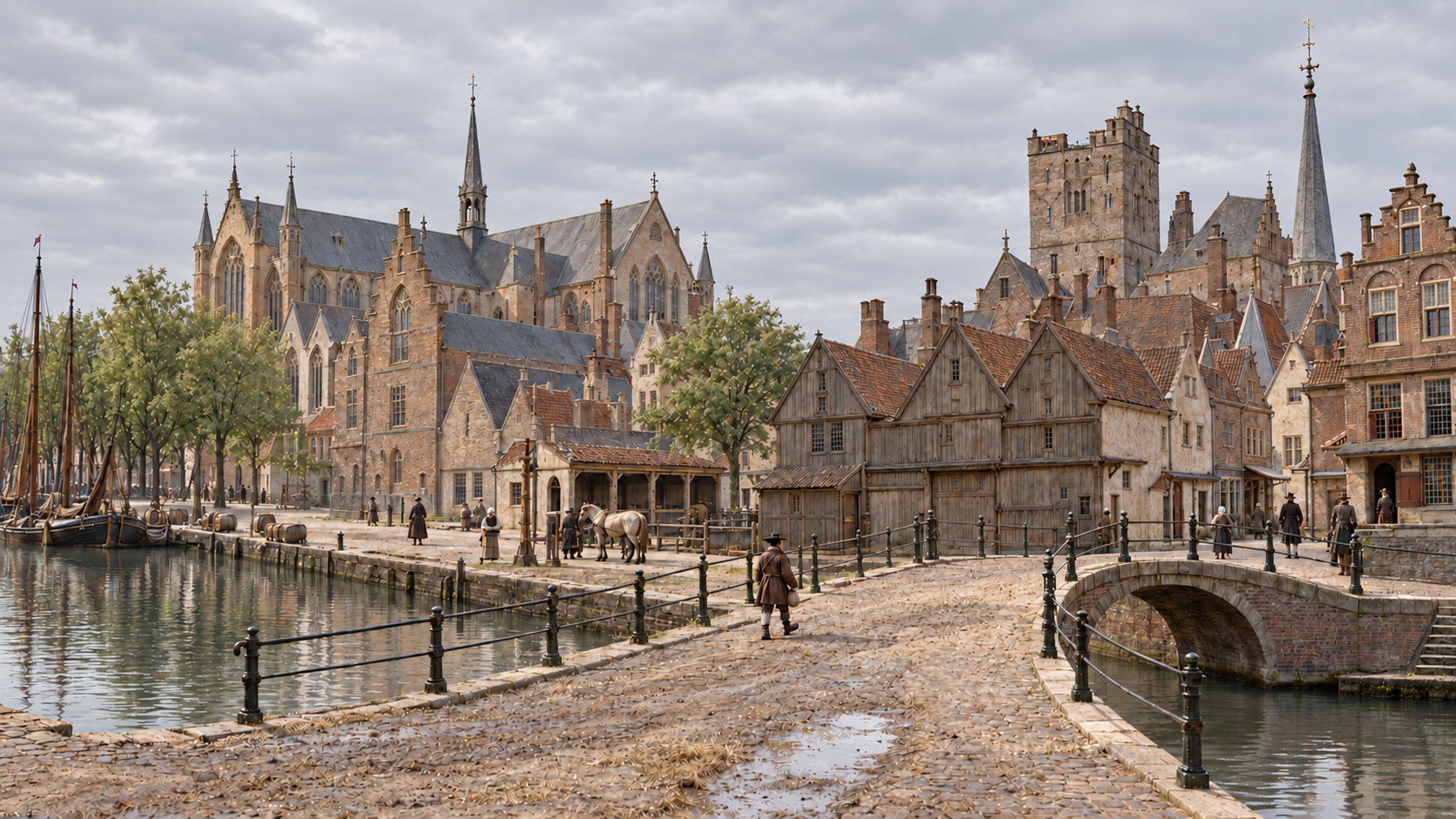
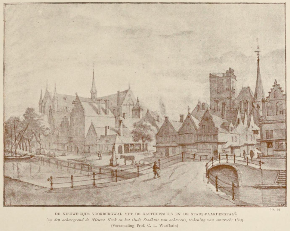
De Nieuwe-Zijds Voorburgwal met de Gasthuissluis en de Stadspaardenstallen. Op de achtergrond de Nieuwe Kerk en het oude stadhuis gezien van de achterzijde (ca 1645).
The Nieuwe-Zijds Voorburgwal with the Gasthuissluis and the city stables. In the background, the New Church and the old city hall seen from the rear (c. 1645).
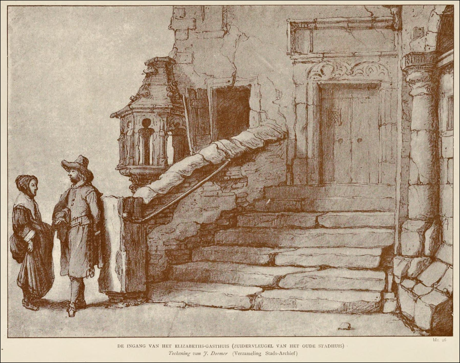
De ingang van het Elisabeth Gasthuis bevond zich aan de zuidvleugel van het oude stadhuis. Tekening van J. Dommer (jaartal onbekend, maar vóór juli 1652, toen het oude stadhuis afbrandde).
The entrance to the Elisabeth Hospital was located on the south wing of the old town hall. Drawing by J. Dommer (date unknown, but before July 1652, when the old town hall burned down).
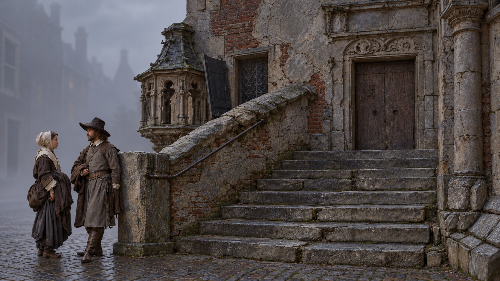
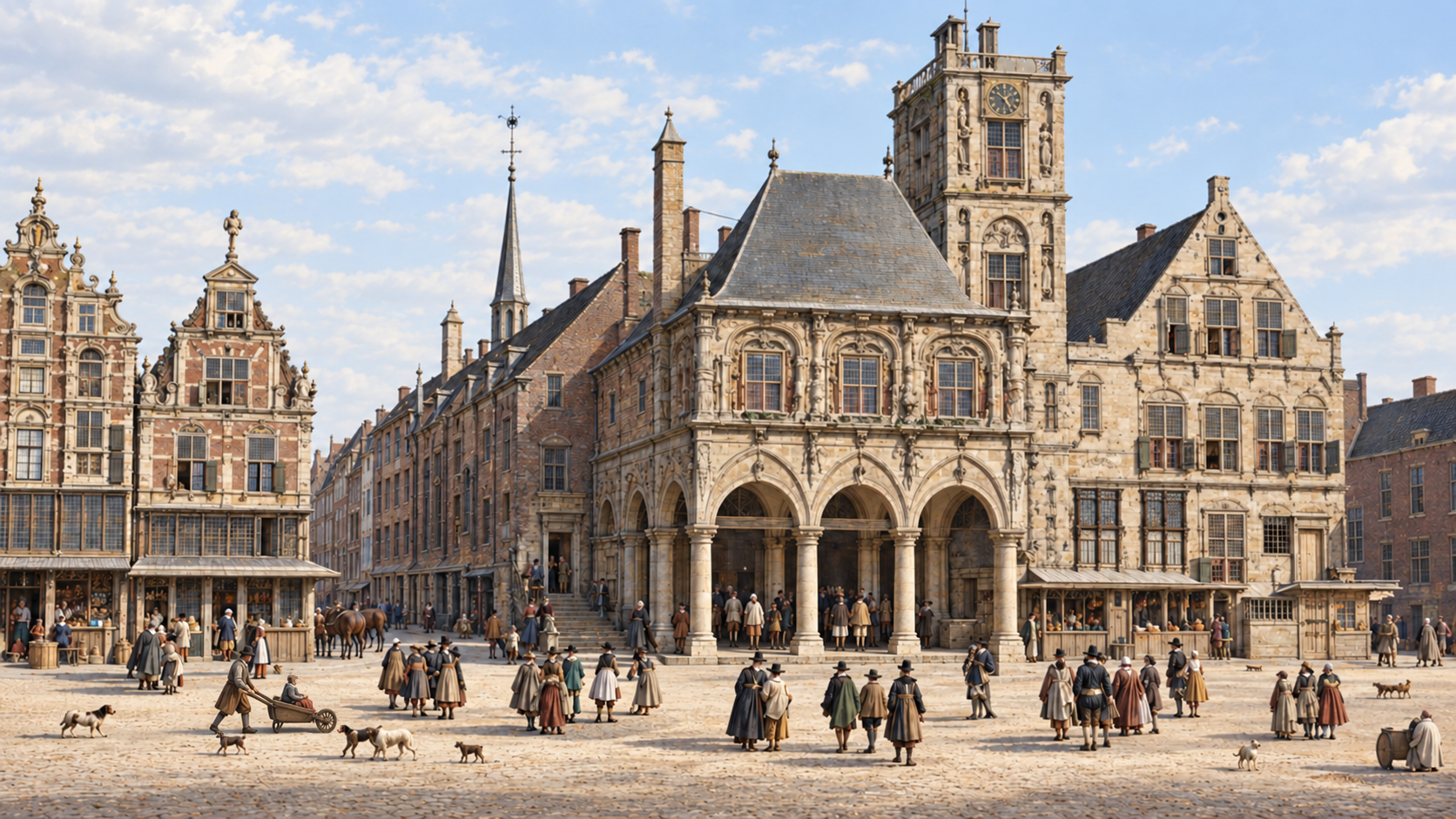
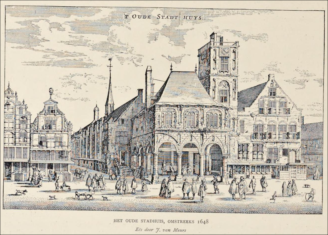
Het Oude Stadhuis, omstreeks 1648, door J. van Meurs. Links van de zuilen is de ingang van het Elisabeth Gasthuis uit het plaatje hierboven.
The Old Town Hall, around 1648, by J. van Meurs. To the left of the columns is the entrance to the Elisabeth Hospital from the image above.
Het Oude Stadhuis van Amsterdam werd op 7 juli 1652 volledig door een brand verwoest. Het werd vervangen door het Nieuwe Stadhuis (het huidige Paleis op de Dam), waarvan de bouw al in 1648 was begonnen en dat in 1655 in gebruik werd genomen.
The Old Town Hall (Oude Stadhuis) of Amsterdam was completely destroyed by fire on July 7, 1652. It was replaced by the New Town Hall (Nieuwe Stadhuis)—the current Royal Palace on Dam Square—construction of which had already begun in 1648 and which was put into use in 1655.
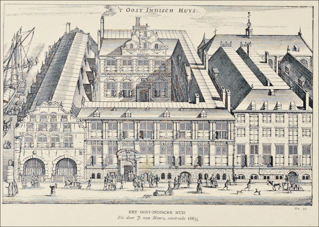
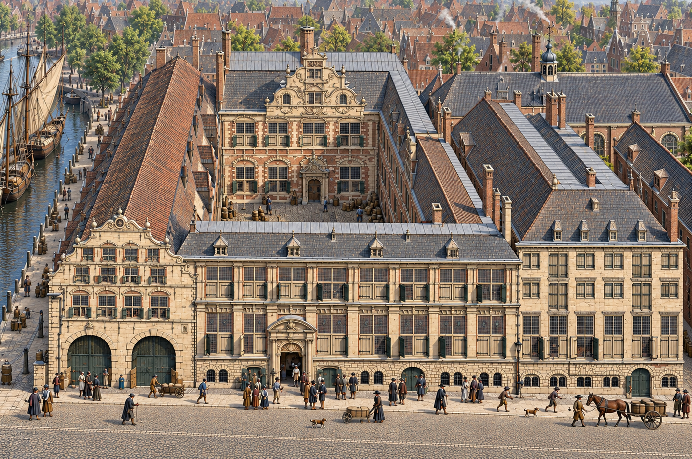
Het Oost-Indische Huis aan de Oude Hoogstraat, op de hoek van de Kloveniersburgwal, 1663. De lange vleugel langs de gracht was het Bushuis, dat de VOC als opslagruimte gebruikte.
The East India House on Oude Hoogstraat, on the corner of Kloveniersburgwal, 1663. The long wing along the canal was the Bushuis (Armoury), which the VOC used as storage space.
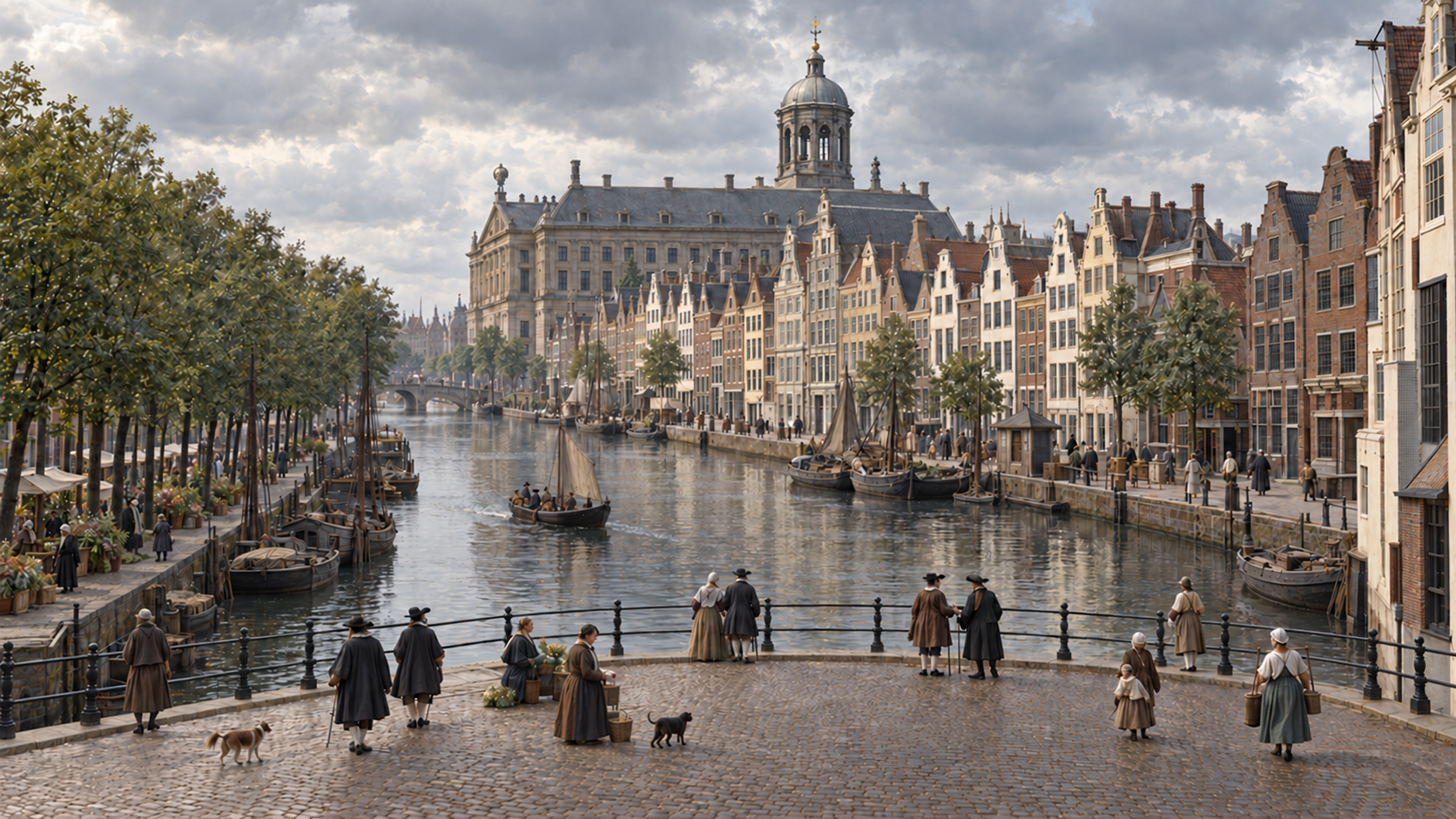
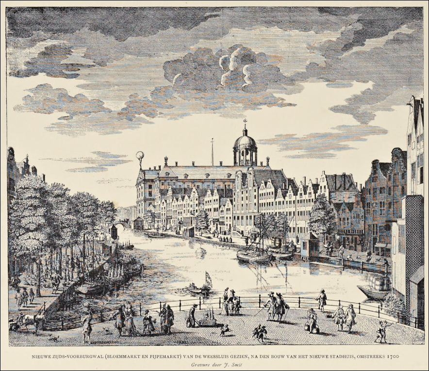
De Nieuwezijds Voorburgwal rond 1700, vanaf de Weessluis gezien, met de Bloemmarkt links, de Pijpenmarkt rechts en het nieuwe stadhuis achter de huizenrij. Gravure door J. Smit.
The Nieuwezijds Voorburgwal around 1700, seen from the Weessluis, with the flower market on the left, the pipe market on the right, and the new town hall behind the row of houses. Engraving by J. Smit.
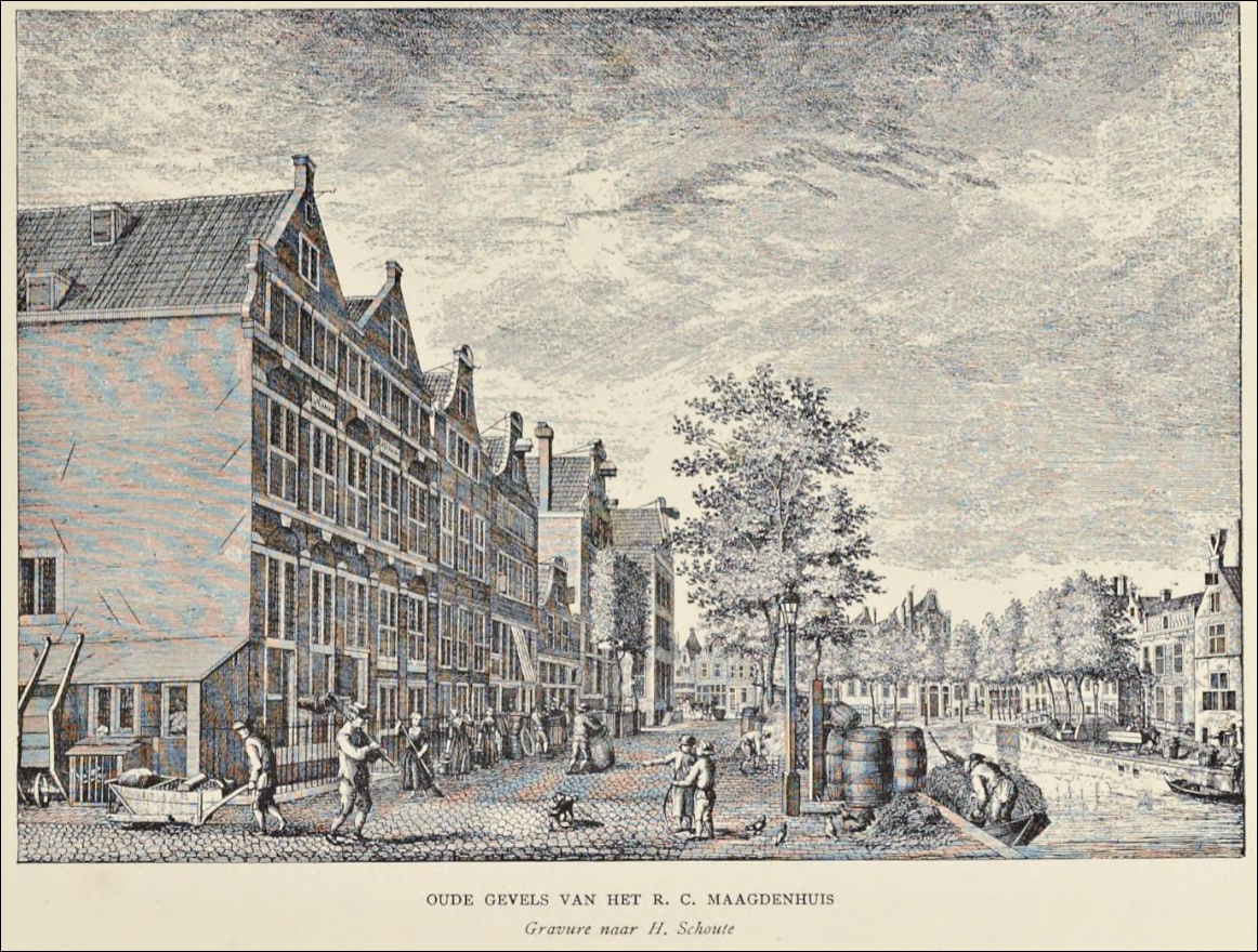
De oude gevels van het Maagdenhuis aan het Spui, naar een gravure van H. Schoute (na 1683). Het gebouw was een weeshuis voor rooms-katholieke meisjes.
The old facades of the Maagdenhuis on the Spui, after an engraving by H. Schoute (after 1683). The building was an orphanage for Roman Catholic girls.
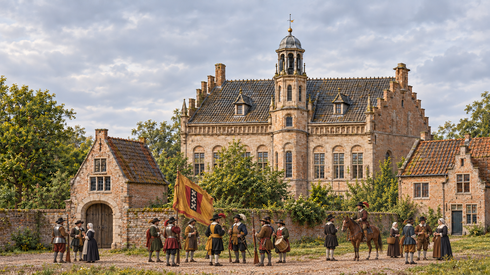
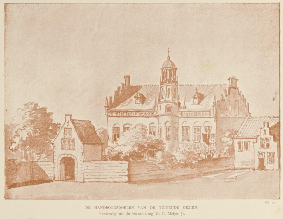
De Handboogdoelen, gezien vanaf de tuinzijde, ergens in de zeventiende eeuw.
The Handboogdoelen, seen from the garden side, somewhere in the seventeenth century.
De Handboogdoelen waren de oefenplaats en het verenigingsgebouw van de Amsterdamse handboogschutters, een onderdeel van de stedelijke schutterij. Zij oefenden er het schieten en kwamen er samen voor vergaderingen, maaltijden en feesten.
The Handboogdoelen was the training ground and headquarters of the Amsterdam longbow archers, a branch of the civic guard. They practiced their shooting here and gathered for meetings, meals, and celebrations.
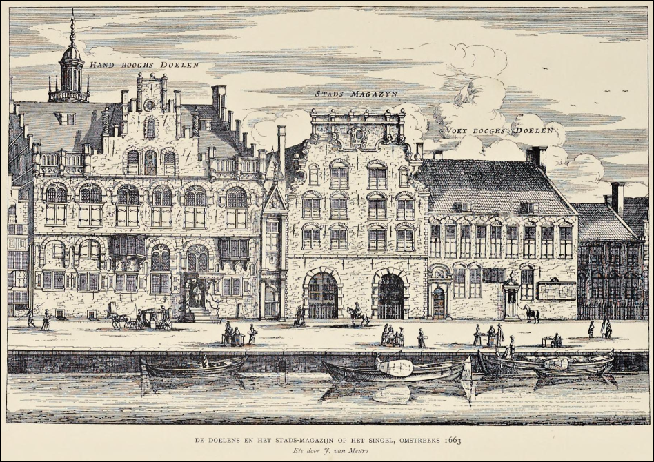
De voorzijde van diezelfde Handboogdoelen aan het Singel, geflankeerd door het Stadsmagazijn en de Voetboogdoelen, omstreeks 1663. Ets door J. Meurs.
The front of that same Handboogdoelen on the Singel, flanked by the Stadsmagazijn and the Voetboogdoelen, around 1663. Etching by J. Meurs.
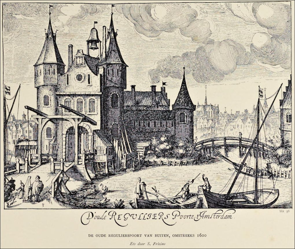
De Oude Regulierspoort aan de buitenzijde van de stad, 1600. Rechts de Roobrug. Ets door S. Frisius.
The Oude Regulierspoort (city gate) on the outer side of the city, 1600. The Roobrug bridge on the right. Etching by S. Frisius.
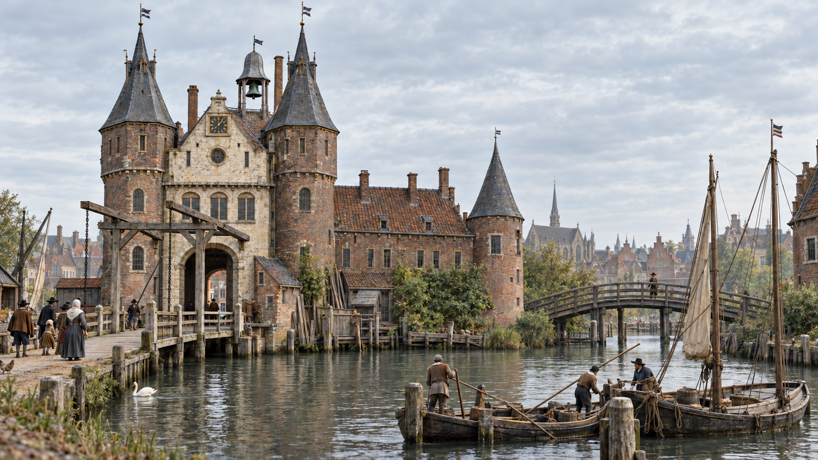
De huidige Munttoren is het restant van de westelijke toren van de Regulierspoort. Na een brand kreeg de overgebleven toren rond 1620 de sierlijke bovenbouw naar ontwerp van Hendrick de Keyser. De kerk rechts op de achtergrond is de Nieuwezijds Kapel, ook bekend als de Heilige Stede.
The current Munttoren (Mint Tower) is the remnant of the western tower of the Regulierspoort. Following a fire around 1620, the remaining tower received its ornate superstructure designed by Hendrick de Keyser. The church in the background on the right is the Nieuwezijds Kapel, also known as the Heilige Stede (the Holy Shrine).
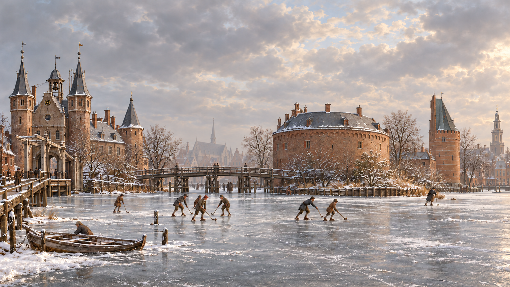
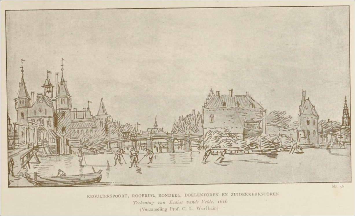
Diezelfde Regulierspoort 16 jaar later. De Roobrug is er nog. Rechts daarvan het Rondeel, daarnaast de Doelentoren en de Zuiderkerk (voltooid in 1612). De jongens op het ijs spelen een vroege vorm van hockey; dit werd 'Colf' genoemd.
The same Regulierspoort 16 years later. The Roobrug bridge is still there. To the right of it is the Rondeel, next to it the Doelentoren, and the Zuiderkerk (completed in 1612). The boys on the ice are playing an early form of hockey; this was called 'Colf'.
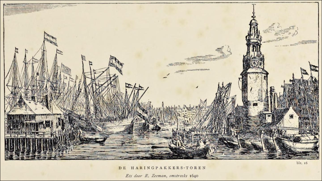
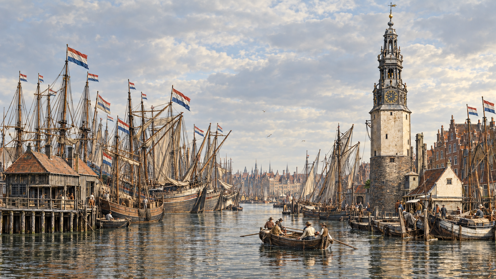
De Haringpakkerstoren aan het IJ, ca. 1640. Links de oude stadsherberg op palen. De haringbuizen liggen zij aan zij.
The Haringpakkerstoren on the IJ, c. 1640. To the left, the old town inn on stilts. The herring busses lie side by side.
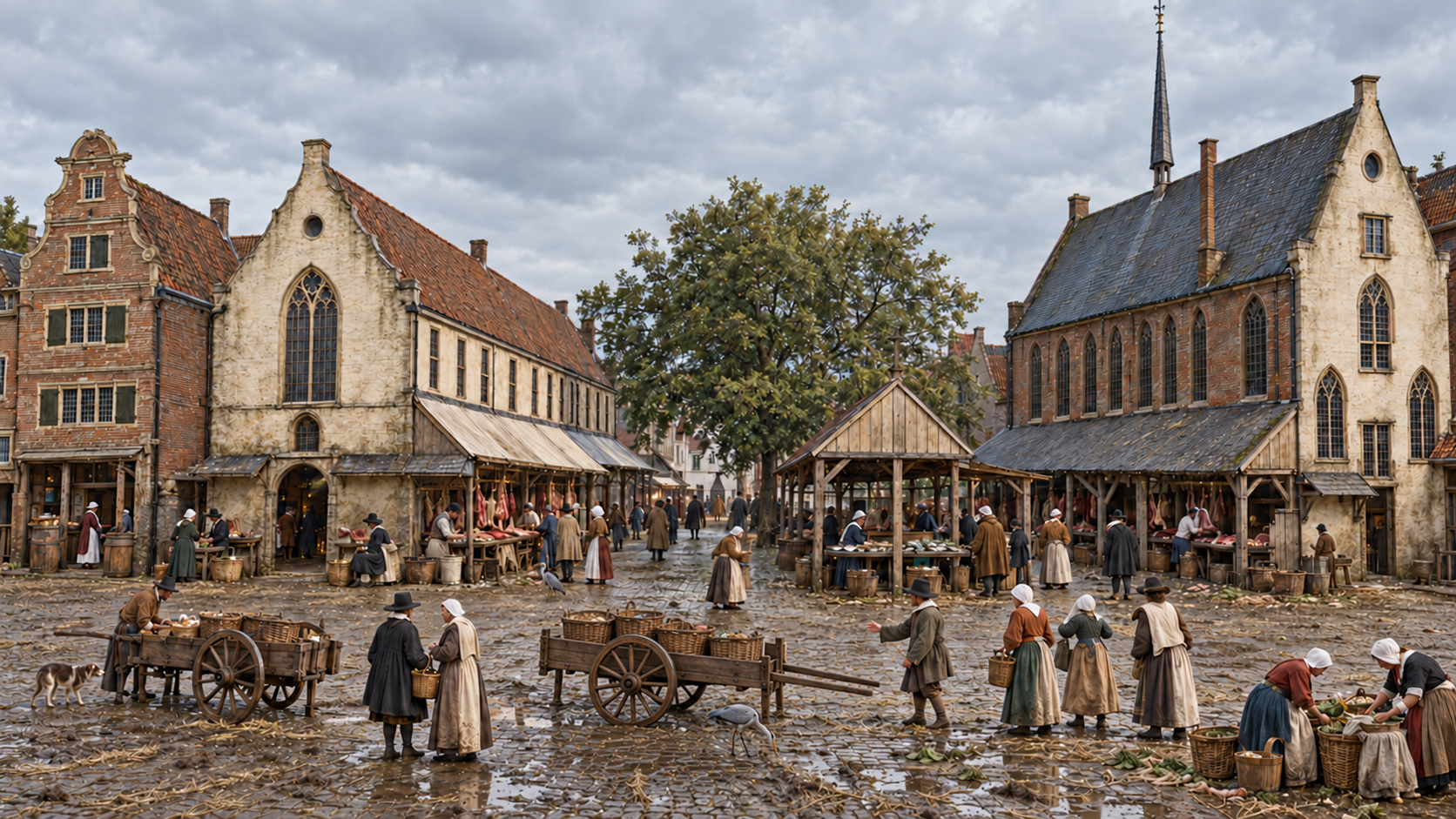
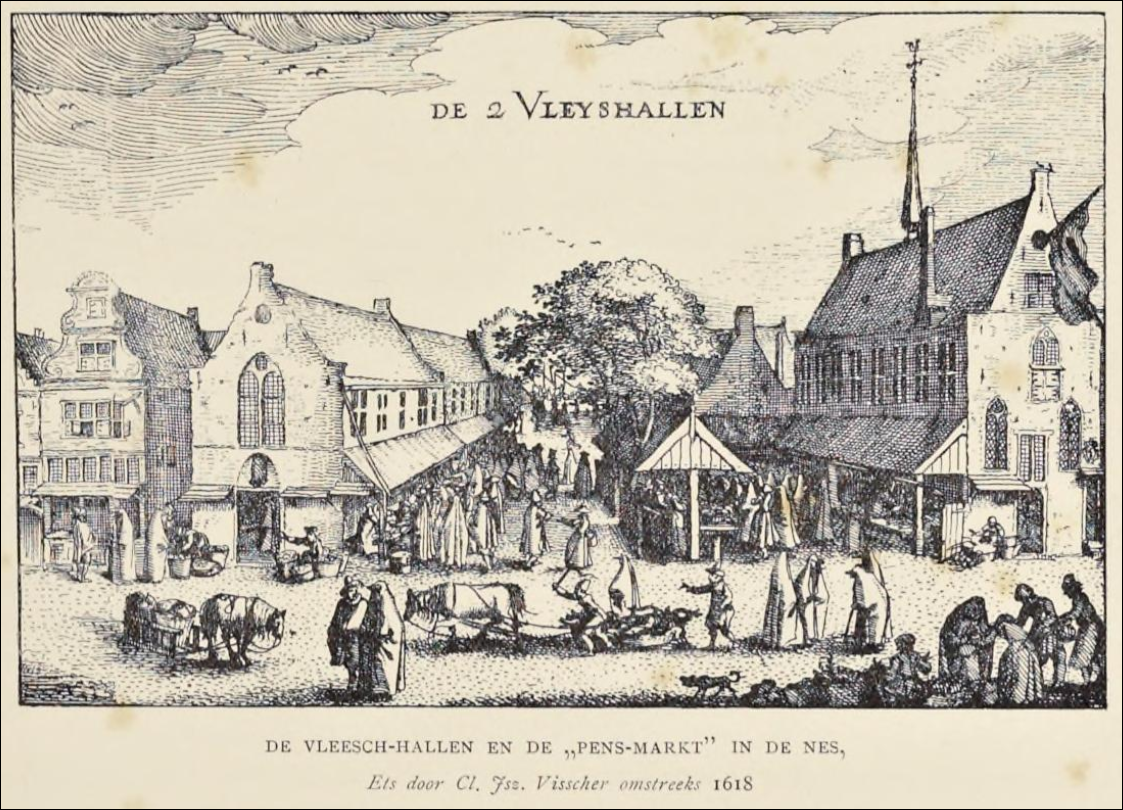
De vleeshallen en de pensmarkt in de Nes, 1618. De twee hallen zijn voormalige kapellen: links de Grote Vleeshal en rechts de Kleine Vleeshal. De markt ertussen werd de Boeren- of Riviervismarkt genoemd.
The meat halls and the tripe market in the Nes, 1618. The two halls are former chapels: the Great Meat Hall on the left and the Small Meat Hall on the right. The market between them was called the Farmers' or River Fish Market.
Wie goed kijkt ziet twee blauwe reigers op straat. Dit is historisch; reigers scharrelden destijds als tamme aaseters over de vlees- en vismarkten.
Those who look closely can see two grey herons on the street. This is historical; at the time, herons scavenged across the meat and fish markets.
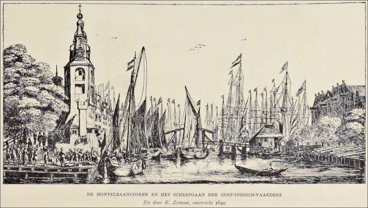
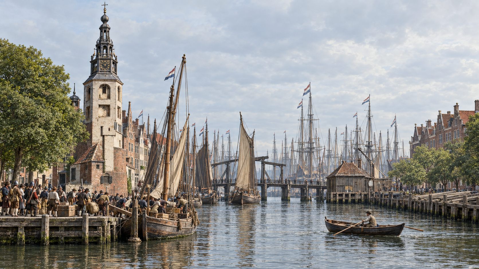
De Montelbaanstoren aan de Oude Schans, ca. 1640. Dit was een van de kades waar de Oost-Injevaarders aan boord gingen van beurtschepen die hen naar de rede van Texel brachten. Op de achtergrond het IJ.
The Montelbaanstoren on the Oude Schans, c. 1640. This was one of the quays where the East Indiamen boarded barge vessels that took them to the Texel roads. In the background, the IJ.
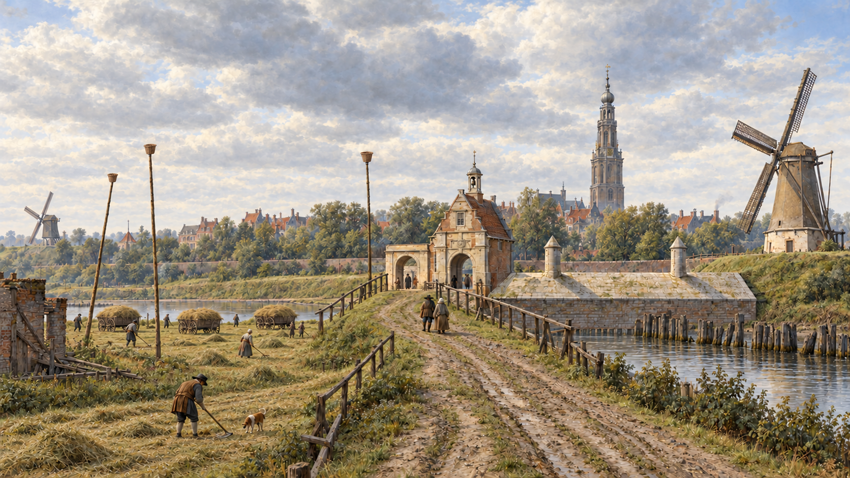
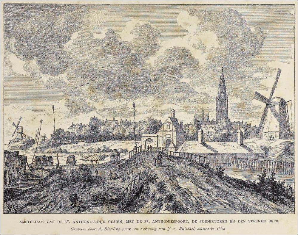
De Sint-Anthoniespoort, de Zuiderkerkstoren en de gemetselde waterkering (stenen beer) omstreeks 1662, naar een tekening van J. van Ruijsdael.
The Sint-Anthoniespoort, the Zuiderkerkstoren (Zuiderkerk tower), and the masonry dam (stenen beer), around 1662, after a drawing by J. van Ruijsdael.
Een hersenkraker waren de drie lange houten palen in de prent. Die komen op meerdere oude gravures voor. Volgens historicus Boudewijn Bakker gebruikten landmeters ze om terreinen voor toekomstige bebouwing te markeren. De opvallende koppen worden expliciet als manden beschreven. Waarschijnlijk is dat deze de meetpunten van verre herkenbaar maakten.
The three long wooden poles in the print presented quite a puzzle. They appear in several old engravings. According to historian Boudewijn Bakker, surveyors used them to mark plots for future construction. The distinctive tops are explicitly described as baskets. This most likely served to make the surveying points recognizable from a distance.
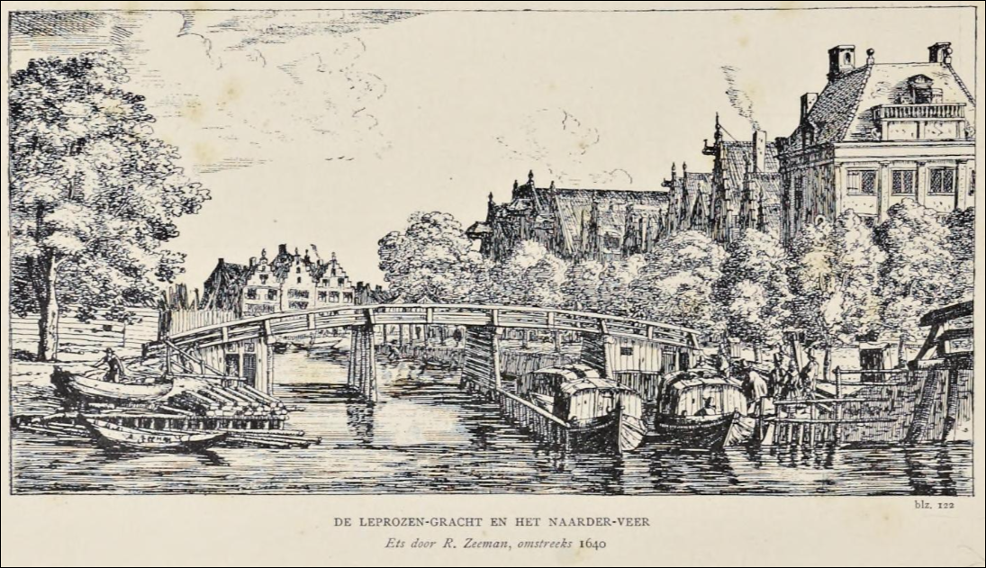
Het Naarderveer aan de Amstel, bij de monding van de Leprozengracht. Passagiers stappen in op de trekschuiten, die hen via Muiden naar Naarden brengen. De originele prent zegt omstreeks 1640, maar museumregistraties dateren deze voorstelling later, vanaf 1657.
The Naarderveer on the Amstel, near the mouth of the Leprozengracht. Passengers board the towboats (horse-drawn boats), which take them via Muiden to Naarden. The original print states around 1640, but museum records date this depiction later, from 1657 onwards.
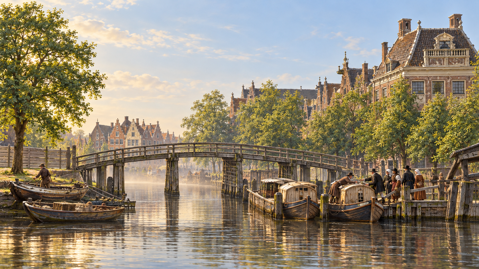
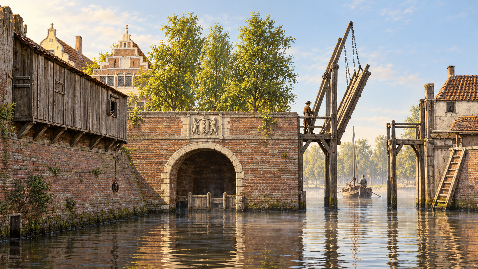
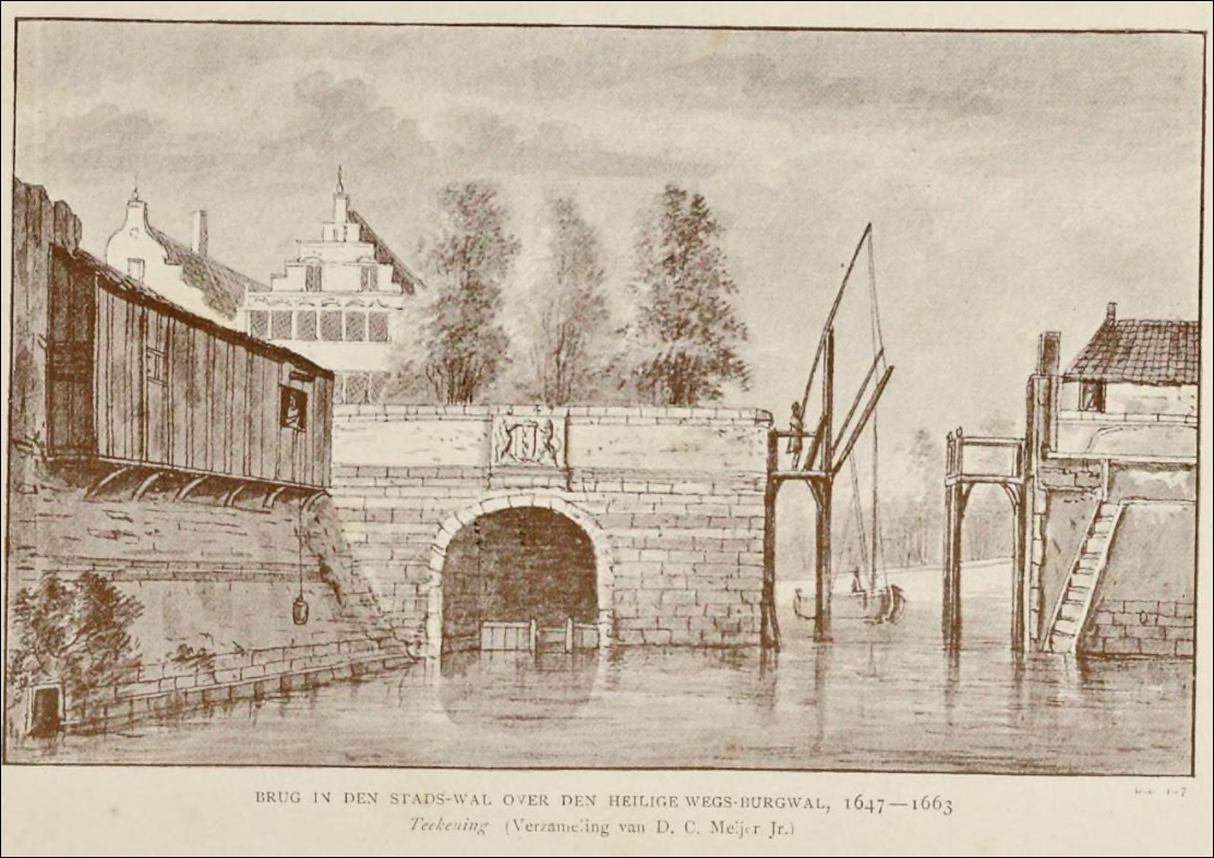
De brug in de stadswal over de Heiligewegsburgwal. Datering 1647-1663.
The bridge in the city wall over the Heiligewegsburgwal. Dated 1647-1663.
De Heiligeweg was de toegangsroute voor bedevaartgangers naar de Heilige Stede, de kapel verbonden aan het Mirakel van Amsterdam uit 1345. Eeuwenlang kwamen pelgrims via deze kant de stad binnen. De Heiligewegsburgwal verbond het Singel met de toenmalige stadsgracht en werd in 1663 gedempt voor de uitbreiding van de grachtengordel.
The Heiligeweg was the access route for pilgrims traveling to the Heilige Stede (Holy Shrine), the chapel connected to the 1345 Miracle of Amsterdam. For centuries, pilgrims entered the city from this side. The Heiligewegsburgwal connected the Singel canal with the city moat of that time and was filled in in 1663 for the expansion of the canal district.
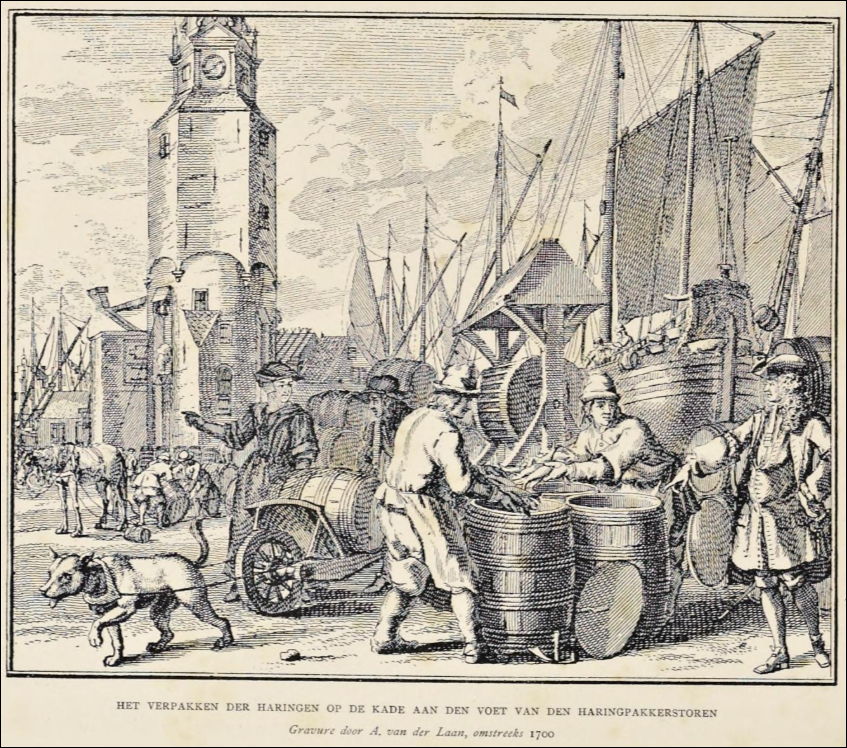
"Het verpakken der haringen op de kade aan de voet van de Haringpakkerstoren." Ca. 1700. De Haringpakkerstoren stond waar het Singel uitmondde in het IJ, bij de Haarlemmersluis.
"The packing of herrings on the quay at the foot of the Herring Packers' Tower." c. 1700. The tower stood where the Singel flowed into the IJ, near the Haarlemmersluis.
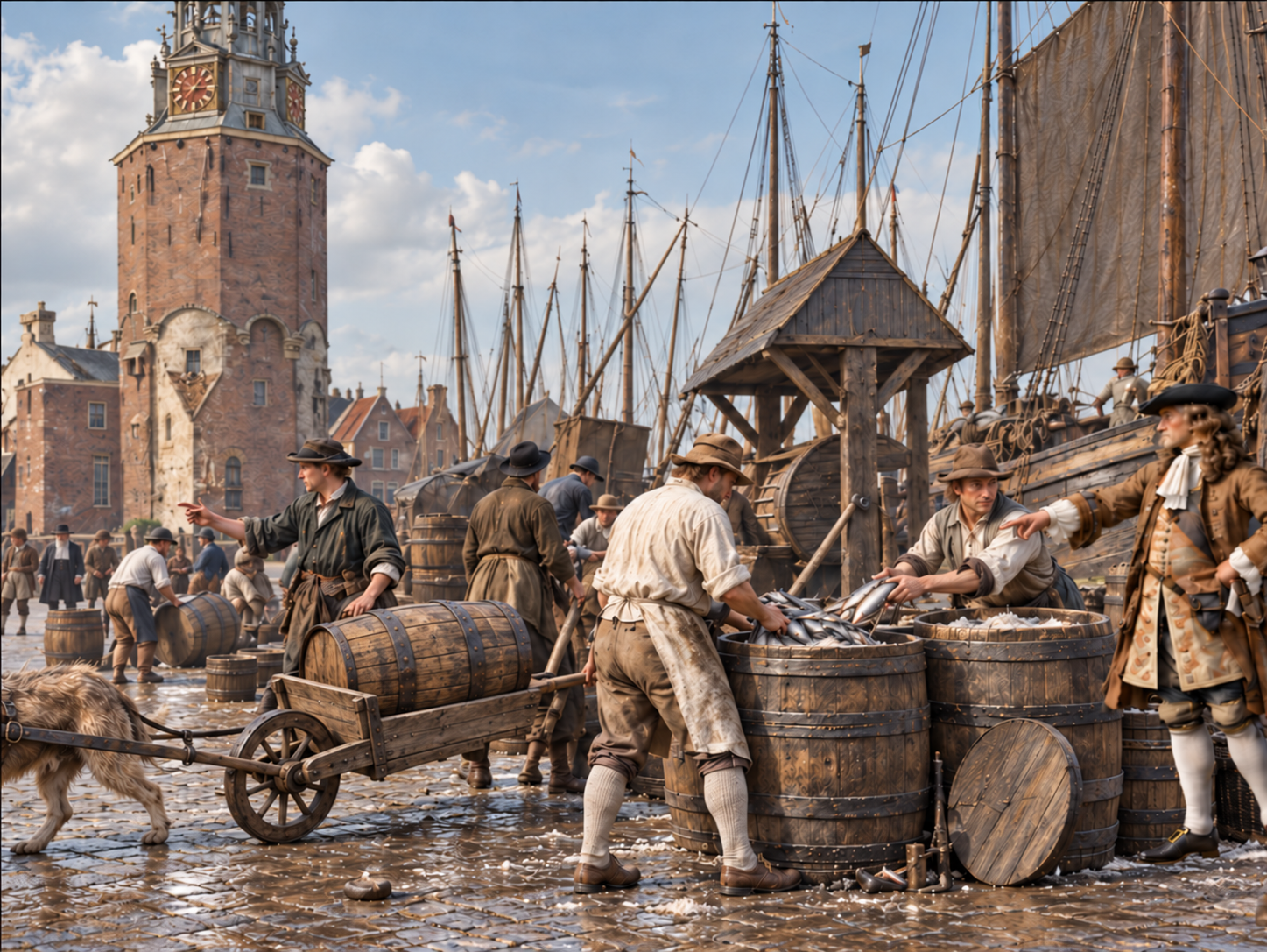
Het betreft op deze plek vooral het overpakken van al gezouten haring. Het kaken en inzouten gebeurde aan boord. Tijdens de reis zakte de inhoud van de tonnen in; eenmaal aan land moesten ze worden geopend, bijgevuld en opnieuw gesloten. Het rad tussen de twee haringpakkers is waarschijnlijk een hijsconstructie, bedoeld om de zware tonnen aan wal te krijgen.
At this location, it mainly concerned the repacking of already salted herring. The gutting and salting were done on board. During the voyage, the contents of the barrels settled; once ashore, they had to be opened, topped up, and sealed again. The wheel between the two herring packers is probably a hoisting mechanism, intended to get the heavy barrels ashore.
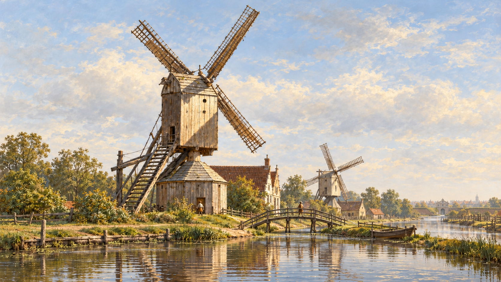
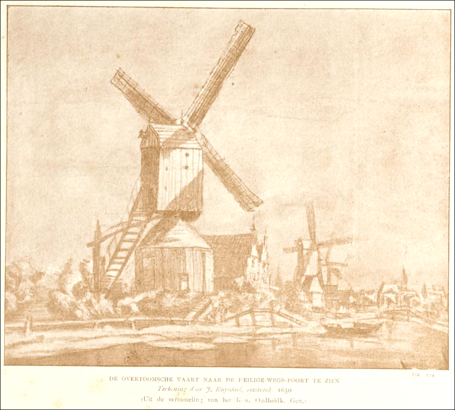
De Overtoomse Vaart richting de Heiligewegspoort, omstreeks 1650, door J. Ruysdaal. De molens en boerderijen stonden buiten de stadsgrens.
The Overtoomse Vaart towards the Heiligewegspoort, around 1650, by J. Ruysdaal. The windmills and farms stood outside the city limits.
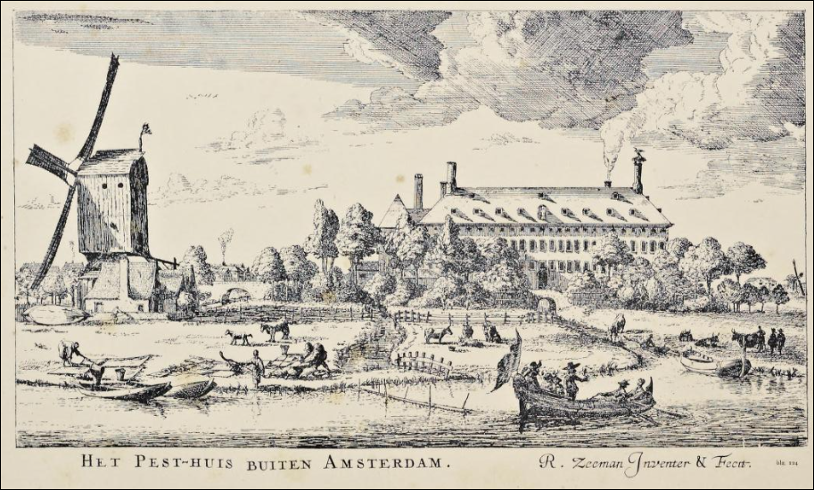
Het Pesthuis buiten de stadsmuren, door Reinier Nooms, omstreeks 1652–1653. Patiënten werden vanuit het Binnengasthuis per schuit over de Pestsloot vervoerd.
The Plague House outside the city walls, by Reinier Nooms, c. 1652–1653. Patients were transported from the Binnengasthuis by barge via the Pestsloot (the Plague Canal).